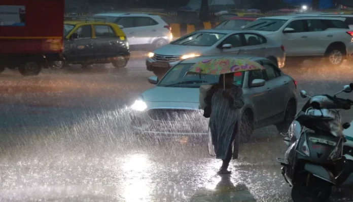
There are indications of heavy rains on August 17 and 18 under the influence of a low pressure area in the Bay of Bengal. Its effect will be seen in many districts including Gwalior-Chambal division.
MP Weather Alert Today: Changes will be seen in the weather of Madhya Pradesh in the next 48 hours. As soon as the new system becomes active, the period of good rains is expected to start again in the state. According to the Meteorological Department, after August 18, 2 new systems are going to be active, due to which there is a possibility of light to moderate rain in the eastern part and heavy rain at some places. Here, Western Disturbance is also active in Jammu and Kashmir, due to which there are indications of moisture coming from the Arabian Sea, while a cyclonic circulation has formed in West Madhya Pradesh, it is expected to bring good rains after 48 hours.
Drizzle in these districts today, new system will be activated after 2 days
According to the MP Meteorological Department, there may be drizzle in some districts of the state including Bhopal, Indore on Wednesday. Due to this, there is a possibility of drop in day and night temperature. There are indications of heavy rains on August 17 and 18 under the influence of a low pressure area in the Bay of Bengal. Its effect will be seen in many districts including Gwalior-Chambal division. However, due to the cyclonic circulation over Rajasthan, the process of rain will continue in the state for the next two days. Between 17 and 22 August, there may be light rain.
Chances of rain between 17 and 22 August
According to the MP Meteorological Department, at present there is a circle of cyclonic winds over Rajasthan, due to which moisture from the Arabian Sea and Bay of Bengal is coming towards Indore, in such a situation, there is a possibility of light rain with thunder today. Has been. There may be drizzle at some places in the districts of the division including Jabalpur in the next 24 hours and moderate rain may start after August 17. There is a possibility of light rain and lightning in the western part. Between 17 to 22 August, there may be cloudy showers.
Weather forecast
According to the MP Meteorological Department, after August 18, the cyclonic circulation system is becoming active in the eastern part, due to which the period of good rains can start once again. Monsoon trough line is likely to come in normal position from Friday. Apart from this, cyclonic circulation is also going to be active, due to which there is a possibility of light to moderate rain in the eastern part of the state and heavy rain at some places.
Here, at present it has gone to Nagaland via Amritsar and Chandigarh in Punjab, Lucknow and Meerut in Uttar Pradesh, Patna and Malda, the capital of Bihar. Western Disturbance is also active in Jammu and Kashmir, due to which moisture will also come from the Arabian Sea. On the other hand, a cyclonic circle has formed in West Madhya Pradesh, due to which the weather is likely to change.


